
- About Sado
About Sado
Geography and Climate
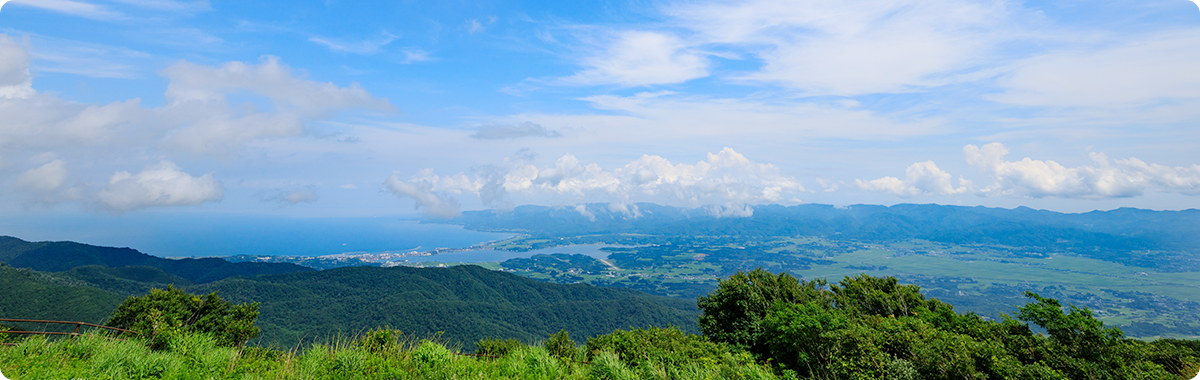
Sado is shaped like an "S" or "Z," with the Osado Mountains, including Kinpokusan of 1,172 metres to the north, the Kosado Mountains including Ojiyama of 645 metres to the south, and the widespread Kuninaka Plain between the two mountain ranges.
Sado Island covers an area of approximately 855 square kilometres, and its coastline stretches approximately 280 kilometres. Sado is the largest island in the Sea of Japan, one and a half times as large as the twenty-three special wards of Tokyo, or Awaji Island (Japan), or Guam or Phuket.
Sado Island's climate is oceanic, with distinct changes across the four seasons. It is hot and very humid in summer. Since Sado is an isolated island off the coast of mainland Niigata, which evokes the images of snow, it is thought to be very cold in winter. However, due to the Tsushima Warm Current which flows off the coast of the island, Sado actually has less snow than the mainland.
Population and Industry
Sado's population is approximately 56,000 as of the end of March, 2018. The main industries on the island are agriculture and fishing, taking advantages of the climate and the soil, which is relatively rich for an island surrounded by the sea.
Farmers grow fruits including Okesa persimmons (Sado's local specialty), Le Lectier pears, and apples, but most farming centers around rice. Moreover, some farmers also practise animal husbandry, including Sado Beef cattle, which are said to be a rare breed from ancient times.
A wide variety of seafood catches are landed, including crab, shrimp, yellowtail, tuna, and so on, as well as oysters farmed in Lake Kamo and Mano Bay, abalones, turban shellfish, and seaweed. Sado is literally a treasure-trove of seafood.